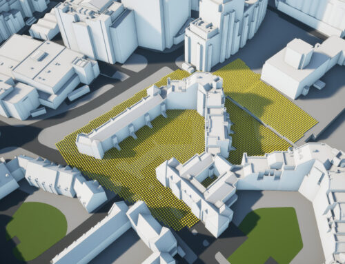
3D City models have been part of architectural design processes and planning for some time now. It would be difficult to imagine how architecture and construction could operate in a global city like London, with its various planning restrictions, without any 3D modelling data. As cities like Hong Kong, Berlin and Singapore take the lead on the availability and quality of their 3D city models, it would be a good time to evaluate and discuss how these initiatives work and whether this approach of a city authority owning and providing the 3D model is the right way of working going forward.
Berlin and Hong Kong local authorities created their own 3D city models, available as downloadable files on their planning websites. This seemingly most efficient approach (build a model once by the city, make use free to all) has many drawbacks. First of all, cost. Creation and management of the dataset, especially highly accurate and detailed one, costs money. It could be argued that these costs should be beared by real-estate developers, not city councils. Second, usability. Both Berlin and Hong Kong created their 3D Models to standards not adopted by the industry in the UK as it does not meet industry needs. These models would be of very limited use to, for example, Rights to Light studies, routinely undertaken in the UK, as these 3D Models are either not accurate enough or only include generalised terrain. And lastly, this business model often leads to limited competition as with free 3D model on the market the rest of the market is not big enough to support multiple data providers.

3D Berlin model in Cesium. See Online Version.
London and many other UK cities, while being very proactive in their technology adoption, benefited from a competition between various suppliers of 3D city models, who supply architects and building consultancies in the same way as laser scanning surveyors or mapping data suppliers. This industry-driven approach gave us 3D city models that are affordable to the industry and often cost nothing to a local authority to produce and use. The drawbacks are clear – local authorities do not own the 3D data of their own cities, have very little control over quality and recency of the data and rely heavily on the industry itself not to build barriers to new entrants to the market.
Overcoming some of these shortfalls, The National Research Foundation of Singapore commissioned an absolute state of the art 3D Model of the entire city, offering connection of a variety of city data to the model, easy citizen access and providing a test-bed for any future technologies, experimentation and IoT data connections. This is the most open and innovative approach to 3D city models in the world but comes with a price tag of cool $73 million. Despite its undoubtful value to both industry and citizens, this is way beyond what current industry suppliers, our customers or local authorities can invest.
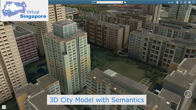
3D model of Singapore. Visit National Research Foundation for more info.
There should be a way for Local Authorities to have some control of the 3D city model data of their own boroughs on behalf of its residents and businesses while not spending tens of millions on the creation of these models. At the same time, Local authorities should not be in a situation where a single company controls a councils access to its own 3D city data. Of course 3D city modelling companies want to protect their Intellectual Property – we are businesses and we have spent a considerable effort developing these datasets and this data helps our customers to add value to all aspects of their work. But 3D city modelling companies should not see Local authorities as customers and more as users and partners.
Working with Local authorities, 3D city model providers should find a way to offer at least parts of their datasets as test beds for any novel and experimental use. London and other UK world-class cities have to stay at the top of the worlds #PlanTech and #PropTech industries. But there is so much more – from Augmented reality for underground utilities, autonomous cars simulations, 5G telecoms and delivery drones navigation – there are world leading experts out there working on solutions to many of our cities problems and should be able to test their ideas in realistic 3D environments. Local authorities should be able to assist these projects while making sure that their 3D model development strategy does not impose unnecessary limitations on other users by preferring specific platform or format.
This article was originally published in RICS Land Journal June – July 2018.