X Y Z Mapping of Cities by AccuCities
X Y Z Mapping is a 3D city mapping process where Z value is captured in 3D space. Our production team is highly skilled and take great pride in capturing highest quality 3D city models. Every point and every line in our 3D city models is manually captured using stereo photogrammetry.
3D City Modelling Technology
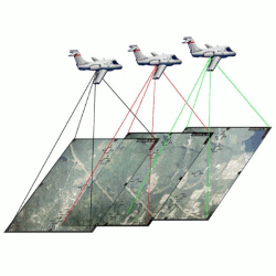
Aerial mapping using Stereo Photogrammetry
Photogrammetry is the science of making measurements from photographs, especially for recovering the exact positions of surface points. We use stereo photogrammetry using latest high-resolution aerial imagery to capture our 3D Models. To explain this fairly complicated process of X Y Z mapping in very few words, as survey plane flies over a city area, it takes series of photographs which overlap by 60%. With each photograph its GPS position, height, tilt, pitch and roll are recorded. Using this data + camera calibration data (to eliminate lens distortion effects), the imagery is triangulated to its correct real-world coordinates.
Once the source aerial imagery is triangulated we can finally start with the capture process. In areas where two images overlap, we project one image into one eye, the second image into another eye and and this way we are able to see the Z value (depth).
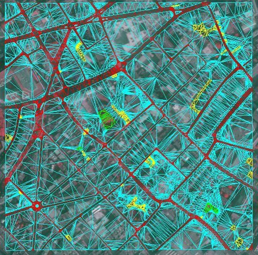
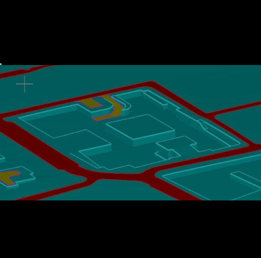
3D Terrain Map from Aerial Photographs
When creating terrain we capture points along curbs of roads, along green spaces and footpaths as well as any significant change in terrain profile. This results in accurate and detailed 3D Terrain map which is further post-processed to make the CAD format solid and separated into layers.
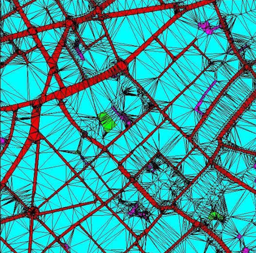
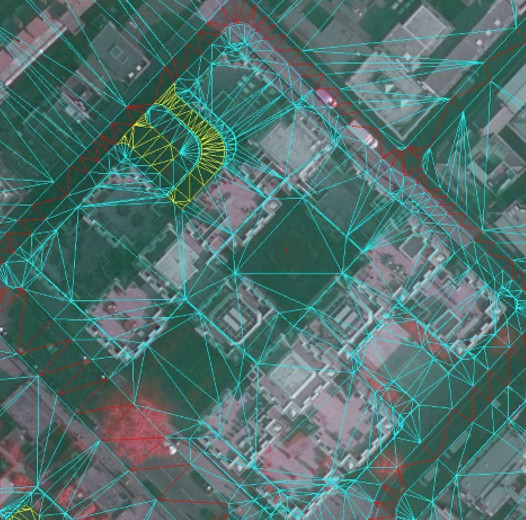
Accurate 3D Buildings Modelling
Once the terrain is captured, we move onto 3D buildings capture. For Level 3 models all roof features are manually captured by highly skilled digital craftsmen, resulting in 3D buildings models with consistent accuracy and correct geometry. Our buildings extent terrain by around 0.5 meter which ensures that models are watertight for applications such as 3D printing.


3D data in layers
Easy to work with
3D models are separated into layers such as Buildings, Roads, Greenspaces, Bridges, Embankment Walls and Trees layer.

Choice of File formats
Best 3D Models for Planning
Delivered in AutoCad Solid DWG, SketchUp SKP and Filmbox FBX formats. The 3D Model is easy to import into Revit, 3D Studio Max, Maya or Cinema 4D.

Long 5 year Licence
Unlimited Users & Projects
Our licence allows unlimited number of users within the company to use of the 3D Model data on multiple projects.

3D printing ready
Flawless results at small scales
The 3D Model of London is made with high-end 3D printing in mind. Files are easy to print using most office and professional 3D Printers.
Custom 3D Models – Available UK Wide
Use our Quoting Tool to send us z map mark-up. 0.1 km2 (330 x 330 meters) 3D Model now only £500 + VAT. Available anywhere in the United Kingdom.
Average Custom 3D Model delivery time: 6 days.

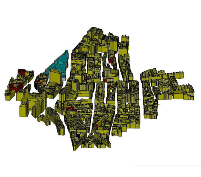
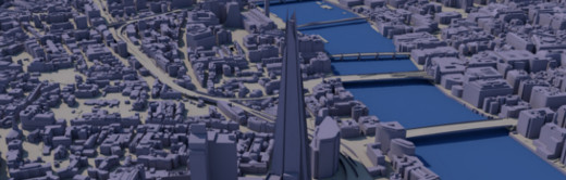
25 km sq Base 3D Model of London
Manually captured from 2016 imagery, this 3D Model covers 25 km2. Light, Detailed & Accurate to 200 cm, the model is easy to work with and fantastic value at less than £200 / km sq. Delivered as .DWG, .SKP or .FBX files.
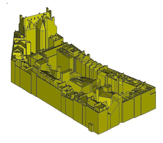
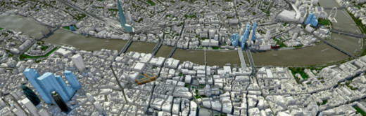
High Detail 3D London Subscription
Subscribers get direct access to 3D Model covering 50+ km2 of central London. Accurate to 15cm, dataset is always updated from latest aerial imagery. Company-wide licence from £1,000 + VAT / month.
Frequently Asked Questions:
3D models are distributed under company-wide, multiple-use licence which covers the use of the 3D model for 5 years. We grant to the User a worldwide, non-exclusive licence to use the 3D Model to unlimited number of Derived products (renders, animations), Incorporated products (Interactive Application, import into custom software), conduct In-house work and use 3D Model data for Physicalization such as 3D printing.
Customers cannot distribute, alter to distribute or re-engineer the 3D model in any way. Read full EULA here.
AccuCities 3D London app is now Plan.City! Please get in touch and we will be happy to set up a meeting to demo the app.
X Y Z Mapping is a 3D city mapping process where Z value is captured in 3D space. Our production team is highly skilled and take great pride in capturing highest quality 3D city models. Every point and every line in our 3D city models is manually captured using stereo photogrammetry.
Both Level 2 and Level 3 3D Models are manually captured from latest aerial imagery available for the area of interest.
 Level 2 3D Models are accurate to 50 cm in all axis. The 3D Model is very light and low poly. Buildings are captured with correct roof shapes of main structures with only chimneys, parapet walls and dormer windows omitted. Terrain is accurate to 20 cm and separated into land use categories. Trees locations (captured with correct height and canopy width) are also included.
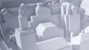
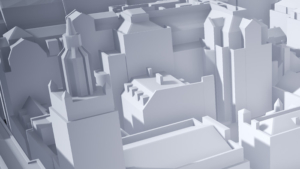 Level 3 3D Models are accurate to 15 cm in all axis. Buildings are captured with correct roof shapes and all features such as chimneys, parapet walls or dormer windows. Terrain is separated into land use categories. Trees locations (captured with correct height and canopy width) are also included.
Any model can be delivered as AutoCad solid .DWG, SketchUp .SKP or .FBX files.
Our High Detail 3D Model of London subscribers also receive Unreal Engine 4 app and all associated UE4 files.
Of course – feel free to Download AccuCities sample tile TQ3280SE. This large 500 x 500 meters sample can be used to evaluate our 3D models. The sample can be downloaded as AutoCad solid .DWG, SketchUp .SKP, FBX and .UE4 Project files as well as Interactive 3D Model. Different Levels of Detail 3D models are available in every format.
X Y Z Mapping is a 3D digital city modelling technology where Z value is captured in 3D space. Utilizing aerial survey for 3D mapping using Stereo Photogrammetry. As survey plane flies over a city area, it takes series of photographs which overlap by 60%. With each photograph its GPS position, height, tilt, pitch and roll are recorded. Using this data + camera calibration data (to eliminate lens distortion effects), the imagery is triangulated to its correct real-world coordinates.
Once the source aerial imagery is triangulated we can finally start with the capture process. In areas where two images overlap, we project one image into one eye, the second image into another eye and and this way we are able to see the Z value (depth).
You don’t need to have an account with us to order 3D models.
We offer up to 80% discounts for students / non-profit projects. Send us your required area via our Quoting Tool and use “Student” instead of company name. Best of luck in your studies!
Level 3 models can be ordered from as little as 0.1 km2 (which is about 330 x 330 meters in real world).
Level 2 models can be ordered from as little as 0.25 km2 (which is about 500 x 500 meters in real world).
Custom 3D models can be ordered in any shape – simply draw a map mark-up , send it over to us and we will come back to you with a quote.
We prefer map mark-ups for quotes to be sent via our Quoting Tool. If you are having any difficulties or have a map in any other format, simply email it to info@accucities.com with your name, company, required Level of Detail and your contact details and we will come back to you.
Business customers will be invoiced with 14 days payment term in or shortly after 3D model delivery. Non-business customers might be asked to pay via Card, PayPal or UK money transfer before we accept an order.
We will usually come back to you within 2 hours with costs and delivery times for your project. Once these are confirmed by you we will order imagery, set-up a Photogrammetry project, manually capture your 3D model, post process the data and deliver the 3D model to you in required format via a download link.
Frequently Asked Questions:
3D models are distributed under company-wide, multiple-use licence which covers the use of the 3D model for 5 years. We grant to the User a worldwide, non-exclusive licence to use the 3D Model to unlimited number of Derived products (renders, animations), Incorporated products (Interactive Application, import into custom software), conduct In-house work and use 3D Model data for Physicalization such as 3D printing.
Customers cannot distribute, alter to distribute or re-engineer the 3D model in any way. Read full EULA here.
AccuCities 3D London app is now Plan.City! Please get in touch and we will be happy to set up a meeting to demo the app.
Both Level 2 and Level 3 3D Models are manually captured from latest aerial imagery available for the area of interest.
Level 2 3D Models are accurate to 50 cm in all axis. The 3D Model is very light and low poly. Buildings are captured with correct roof shapes of main structures with only chimneys, parapet walls and dormer windows omitted. Terrain is accurate to 20 cm and separated into land use categories. Trees locations (captured with correct height and canopy width) are also included.
Level 3 3D Models are accurate to 15 cm in all axis. Buildings are captured with correct roof shapes and all features such as chimneys, parapet walls or dormer windows. Terrain is separated into land use categories. Trees locations (captured with correct height and canopy width) are also included.
Any model can be delivered as AutoCad solid .DWG, SketchUp .SKP or .FBX files.
Our High Detail 3D Model of London subscribers also receive Unreal Engine 4 app and all associated UE4 files.
Of course – feel free to Download AccuCities sample tile TQ3280SE. This large 500 x 500 meters sample can be used to evaluate our 3D models. The sample can be downloaded as AutoCad solid .DWG, SketchUp .SKP, FBX and .UE4 Project files as well as Interactive 3D Model. Different Levels of Detail 3D models are available in every format.
You don’t need to have an account with us to order 3D models.
We offer up to 80% discounts for students / non-profit projects. Send us your required area via our Quoting Tool and use “Student” instead of company name. Best of luck in your studies!
Level 3 models can be ordered from as little as 0.1 km2 (which is about 330 x 330 meters in real world).
Level 2 models can be ordered from as little as 0.25 km2 (which is about 500 x 500 meters in real world).
Custom 3D models can be ordered in any shape – simply draw a map mark-up , send it over to us and we will come back to you with a quote.
We prefer map mark-ups for quotes to be sent via our Quoting Tool. If you are having any difficulties or have a map in any other format, simply email it to info@accucities.com with your name, company, required Level of Detail and your contact details and we will come back to you.
Business customers will be invoiced with 14 days payment term in or shortly after 3D model delivery. Non-business customers might be asked to pay via Card, PayPal or UK money transfer before we accept an order.
We will usually come back to you within 2 hours with costs and delivery times for your project. Once these are confirmed by you we will order imagery, set-up a Photogrammetry project, manually capture your 3D model, post process the data and deliver the 3D model to you in required format via a download link.
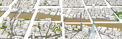
Top Planning Consultants use AccuCities 3D City Models
