3D city maps are used by architects for a wide range of applications. It is necessary for architects to understand the spatial context of development. RIBA Plan of Work has been updated in 2020. The new Stage 3 “Spatial Coordination” replaces “Developed Design” and represents a clear deadline for architects to take the wider context of their proposal into account. However, it is a task of Stage 1 to source Site information and Site Survey and 3D models of the as-built environment are often already used in stage 0 for the initial Site Appraisal.
To do this, architects usually take advantage of existing 3D city maps or commission or even create their own 3D model of a city area. The term “3D model” is an overarching term covering everything from simple extruded map polygons models all the way to custom-made millimeter-accuracy 3D scans. 3D city maps vary greatly in terms of their costs, delivery time and its file format as well as in terms of their accuracy, level of detail, recency and usability.
In these videos, you can learn about top 5 city models used by architects, developers, surveyors, planning consultants and construction companies.

Part of fully accredited RIBA CPD material
This material is from RIBA CPD video and forms a part of the ribacpd.com digital CPD mix of RIBA-approved CPD material. The seminar is listed under “Places, planning and communities” and “Design, construction and technology”. As this is an introductory overview of 3D city models in architecture, the knowledge level is General Awareness.
Watch this CPD video on ribacpd.com: Overview of 3D city models for Architects.
Compared 3D city models
Extruded Footprint Polygons
Lidar City Models
Aerial Photogrammetry 3D City Models
Textured Photogrammetry 3D City Models
Game-ready 3D City Models
Watch the Overview of 3D city models on YouTube.
The term “3D model” is an overarching term covering everything from simple extruded map polygons models all the way to custom-made millimeter-accuracy 3D scans. The 3D models vary greatly in terms of their accuracy, level of detail, recency and usability, as well as in terms of their costs, delivery time and its file format. Learn about the suitability of each type of city model for architects.
Case Studies Reference:
3D city models examples of the use of Extruded footprints polygons 3D city maps by architects.
Photogrammetry 3D model of Cardiff by AccuCities
Cardiff Arena Level 4 model by Oasis Cities
Extruded Polygons 3D model of Cardiff by Open Street Map
3D London in UE4-powered Urban planning app by Plan.City
Extruded Polygons 3D model in Plan.City by Open Street Map
Extruded Polygons 3D New York model in Cesium
3D city models examples of the use of Lidar 3D city maps by architects.
LIDAR Composite DSM 2017 dataset by Environmental Agency
Make 3D printable terrain tiles from LIDAR data by Andrew Godwin
LIDAR Composite DSM 2017 dataset by Environmental Agency
Wind, datasets improvements and 3D from satelite lidar referenced in the video
The flood map for planning by Environmental Agency
EA Flood map in 3D London by Plan City
3D city models examples of the use of Photogrammetry 3D city maps by architects.
Photogrammetry 3D city models by AccuCities
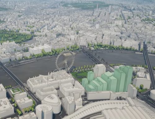
Maximum Building Envelope design
Visual Skycomponent Study in Plan.City
Maximum Building Envelope design in Plan.City
Mapping Underground networks by Oasis Cities
3D London model in Planbase by 3D Repo
Public Consultation Boards by Weston Williamson LLP
3D London in SimScale wind comfort simulation
Various Planning Studies by EB7
Accurate Visual Representation Birmingham by EB7 Immersive
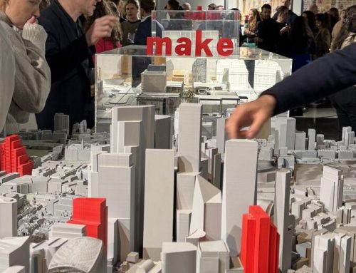
Site Design in Central London (bid) by BAM Construction
Digital walks with microbes by Ioana Man
3D city models examples of the use of photogrammetry captured, textured 3D city models by architects.
Textured Photogrammetry 3D London model by AccuCities
Improving Textures on focus buildings in Plan.CityPlan.City
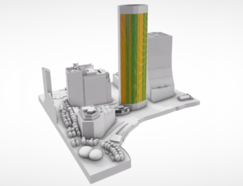
Reflection CGI of planned development in Textured Photogrametry model
Interior render in UE4 with an accurate city model background
3D city models examples of the use of photogrammetry captured, textured 3D city models by architects.
3D model of London in various games
3D model of London in MS Flight Simulator
Pros and cons of games City models